Waze Map Editor/en: verschil tussen versies
Nieuwe pagina aangemaakt met '35xpx|Ruler Measure the distance between two points.' |
Nieuwe pagina aangemaakt met '35xpx|Streetview Request Streetview at the current location.' |
||
| Regel 55: | Regel 55: | ||
[[File:NL-WME-Liniaal.png|35xpx|Ruler]] Measure the distance between two points. | [[File:NL-WME-Liniaal.png|35xpx|Ruler]] Measure the distance between two points. | ||
[[File:NL-WME-Streetview.png|35xpx|Streetview]] Request Streetview at the current location. | |||
[[File:NL-WME-Streetview.png|35xpx|Streetview]] | |||
<div lang="nl" dir="ltr" class="mw-content-ltr"> | <div lang="nl" dir="ltr" class="mw-content-ltr"> | ||
Versie van 16 apr 2025 15:03
Waze map editor
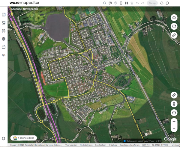
The Waze Map Editor (WME) maintains the Waze map. How we do this in the Netherlands is - to start - explained in the: Quick start guide. More information for beginners can be found in the Starters Summary.
For explanations of the buttons, menus, and other items on the editor screen, see the Waze Map Editor Legend.
Location
Before you start editing the map, you need to find the location you want to work on. If you have a Permalink, you can enter it in the URL browser field. Otherwise, you can search by city and/or street using the ![]() search field at the top center of the screen.
search field at the top center of the screen.

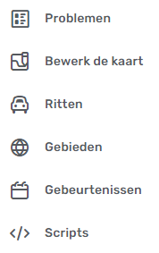
The left strip of the editor screen contains the left hand side menu. When you click on this, it expands and you can choose from a range of aspects:
![]() Issues: For working with User update requests (UR), Place update requests (PUR) and Map problems (MP) and Map suggestions (MS).
Issues: For working with User update requests (UR), Place update requests (PUR) and Map problems (MP) and Map suggestions (MS).
![]() Edit Map: To modify the data of the currently selected map element.
Edit Map: To modify the data of the currently selected map element.
![]() Drives: For an overview of your past drives with Waze.
Drives: For an overview of your past drives with Waze.
![]() Areas: For an overview of your Areas where you can edit the map.
Areas: For an overview of your Areas where you can edit the map.
![]() Gebeurtenissen: for working with Major Traffic Events.
Gebeurtenissen: for working with Major Traffic Events.
![]() Scripts: with the settings of the installed Scripts.
Scripts: with the settings of the installed Scripts.
en bottom left hand side:
![]() Settings: Here you can adjust some settings.
Settings: Here you can adjust some settings.
At the top of the screen the menu is displayed with a number of icons next to the search field.
![]() Clicking this icon will display options for adding a Map Comment.
Clicking this icon will display options for adding a Map Comment.
![]() Via this option it is possible to add a Place.
Via this option it is possible to add a Place.
![]() Via this option it is possible to add a road.
Via this option it is possible to add a road.
![]() This option provides support for working with areas.
This option provides support for working with areas.
![]() This option allows maintenance of Hazards such as speed cameras, level crossings, toll booths.
This option allows maintenance of Hazards such as speed cameras, level crossings, toll booths.
![]() Share location, with this button you can request a permalink and the coordinates of the current location.
Share location, with this button you can request a permalink and the coordinates of the current location.
![]() Measure the distance between two points.
Measure the distance between two points.
![]() Request Streetview at the current location.
Request Streetview at the current location.
![]() Gebruik deze + en - om in- en uit- te zoomen. Met de cursor op deze knop wordt het huidige zoomniveau aangegeven.
Gebruik deze + en - om in- en uit- te zoomen. Met de cursor op deze knop wordt het huidige zoomniveau aangegeven.
Onderste regel
Door te klikken op ![]() kun je jezelf zichtbaar maken voor andere editors die in hetzelfde gebied de WME kaart open hebben staan. Met zichtbare editors kun je chatten.
kun je jezelf zichtbaar maken voor andere editors die in hetzelfde gebied de WME kaart open hebben staan. Met zichtbare editors kun je chatten.
Via klikken op Sneltoetsen wordt een panel opgeroepen met beschikbare toetscombinaties waarmee je editacties kunt verrichten en instellingen kunt veranderen.
Door het klikken op Krijg hulp wordt de main page van de community hub site opgeroepen. Naast de wiki een extra site met uitleg over het bewerken van de Waze kaart.
| 100 m | Geeft de maataanduiding aan bij het huidige zoom niveau.
De getallen rechtsonder, zoals 52.98689, 6.56409, geven de coördinaten van de huidige locatie aan.
Via klikken op Livekaart wordt de [Live map] bij de huidige locatie opgeroepen.
Verder lezen
- Map Editor Interface and Controls bevat een complete beschrijving van de Waze Map Editor.
- Additional editing tips pagina.
- Map Editing Tips and Hints
- De Waze Map Editor Forum pagina met discussies, suggesties en informatie over de laatste wijzigingen.

