WME Geometries/en: verschil tussen versies
Uit Wazeopedia Nederland
wazeopedia>Kamonu Geen bewerkingssamenvatting |
k 1 versie geïmporteerd |
(geen verschil)
| |
Huidige versie van 22 feb 2025 om 10:34
WME Geometries
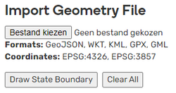
WME Geometries is a script that can load a geometry file and overlay it in the WME. Simply go to the Areas tab on the left, and scroll down to the new controls that have been added.

The data format is detected automatically using the file extension, and the following formats are supported: GeoJSON, GML, WKT, KML and GPX.
The script setting can be found on the Areas tab, below the editable areas. Position the map on the location of the geometry file. The geometry lines will be visible as blue lines.
